BURRAGORANG VALLEY WALK
15 Jun 2020
Great sandstone cliffs and pristine bushland will be available for all to see on a new 300km bushwalk planned for Sydney’s southwest that stretches from the Blue Mountains to Mittagong.

The project is part of a bold new plan being developed by Wollondilly Council to tap into the region's tourism and economic potential. Deputy Mayor Matt Gould said council adopted an ambitious prospectus at a meeting this week to make the walk world-class. "Most people, when we talk about this, are excited," he said.
The path links the Wollondilly, Wingecarribee and Blue Mountains, making it a regional project that could really be a transformative boost for the local economy.
The circular walk includes Warragamba, through the back of the Sydney water catchment to Oakdale, then Thirlmere Lakes to Buxton and on to Mittagong, back through to Yerranderie and up the western side of the dam to Wentworth Falls. 
Wollondilly Council released an ambitious vision a 300-kilometre busk walk through the Burragorang Valley. ABC Illawarra: Kelly Fuller
"Most of the trails already exist, the project would connect the tracks and ensure they are clearly marked." Cr Gould said.
He also hopes the trail shines a spotlight on the old silver mining town of Yerranderie. Once a thriving silver mining town, most of its jobs were lost in a national strike in the 1920s. The town was further isolated from Sydney when the catchment was filled to create Warragamba Dam.
A wealthy benefactor bought the town from a mining company and, together with a small group of locals, they have dedicated their lives to preserving its old buildings.
Some of the walk would cross land identified as part of the catchment and the council is negotiating with state authorities to gain access. 
The proposed 316-kilometre Burragorang Valley Walk map. Supplied by Wollondilly Council
Council expects the project would cost about $3.7 million including improvements to roads, parking, and other amenities.


MORE NEWS
STRIKING GOLD IN BALLARAT
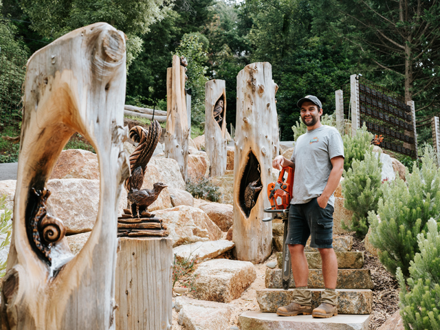
WOOD CARVING WITH BRANDON KROON

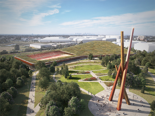
HARNESSING THE POWER OF DESIGN TO TRANSFORM CITIES

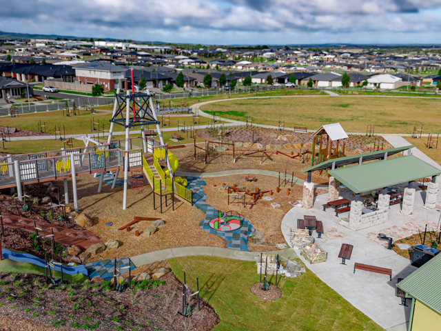
MASTERPLAN FOR INCLUSIVE, CLIMATE-RESILIENT COMMUNITY PARK IN LISMORE
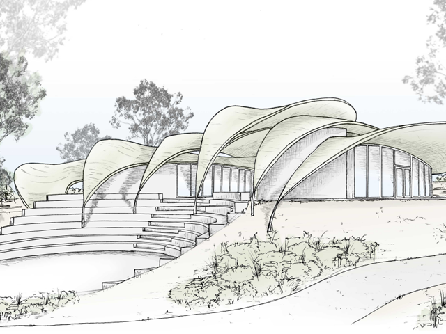
JARRAHDALE TRAIL CENTRE TAKES DESIGN CUES FROM NATIVE FLORA